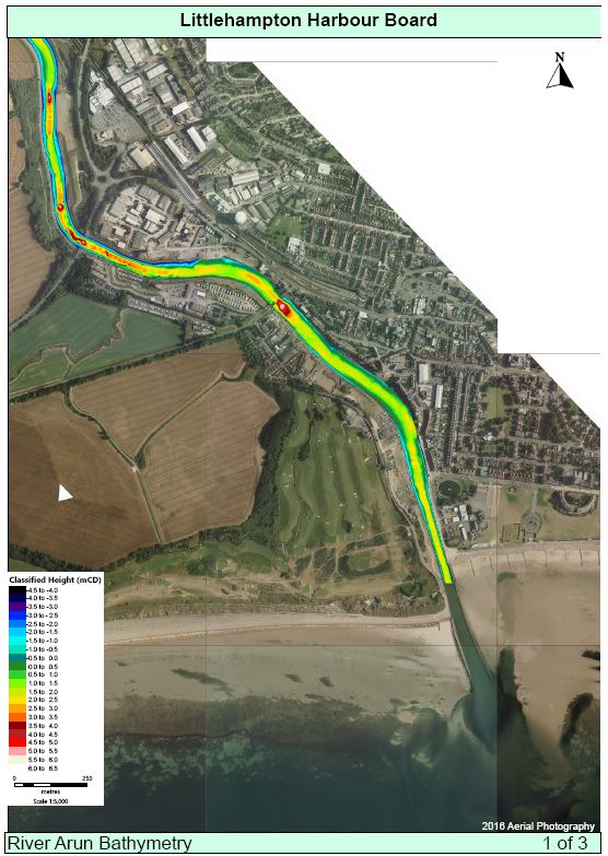
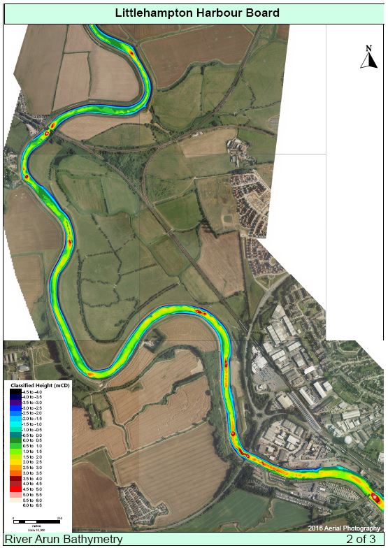
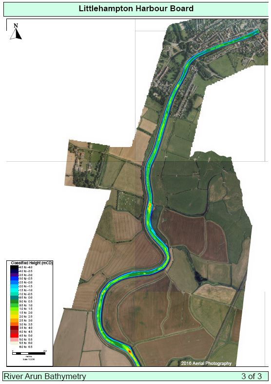
The harbour’s interior is surveyed in full periodically in line with our Conservancy Policy. The last complete harbour multibeam bathymetric survey was in Febuary 2020. The output is split into three charts covering up-river (Arundel to Ford), mid-river (Ford to Littlehampton) and down-river (the main harbour area south of the A259 bridge).
Click on the following previews to zoom in or download:
The area to the south of the light house at the harbour entrance has been ommitted from the above survey as it is subject to change more regularly. Navigation in this area should be with due regard for Admiralty Chart 1991 (preview below) as well as the following two standing Local Notices to Mariners. Further advice on harbour entry is available here.

The controlling depth for Littlehampton Harbour is at the harbour entrance at 0.9m above chart datum. This area is constantly surveyed to ensure there is no change to underkeel clearances.
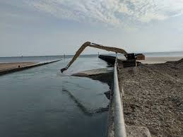
Dredging:
The shoal bank is typically dredged using shore-side excavators at least twice per year. There is currently no other requirement for dredging to maintain navigable channel depths elsewhere in the harbour. The bar is maintained at 0.9m over datum by the natural scour effect of the River Arun. The various mooring operators arrange more regular local surveys and local dredging of berths as required.
Any dredging in the harbour must be discussed and approved with the Harbour Master. Dredging may also require a Marine Licence from the Marine Management Organisation (MMO). For more information about dredging in the harbour, and to assist with any Marine Licence application, please refer to the the Harbour’s Dredge Baseline Document.